Locality data
Submitted by Administrator on Wed, 11/14/2007 - 15:25.
Field names given bold and underlined are necessary for meeting GBIF compatibility and the needs of conservation strategies.
| No. | Locality data | Explanation | Example |
| 1 | Locality code | A unique code for this locality | MMB2007-1 |
| 2 | Country | The English name of the country where the fieldwork took place. | France |
| 3 | ATBI site | The name of the ATBI site (use the same nomenclature as on http://www.atbi.eu/forum/?q=node/682) | "Mercantour/Alpi Marittime" |
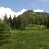
| 4 | Full locality name | The full description of the locality, indicating important nearby topographic landmarks in the order from large (e.g., region's name) to small scale (e.g., name of the road) | "Gorge De Saorge, near Fontan along Road N204" |
| 5 | Longitude | The longitude as given by the source in decimal degrees | 7,55000000 |
| 6 | Latitude | The latitude as given by the source in decimal degrees | 44,00000000 |
| 7 | Minimum altitude | The minimum altitude of the locality as given by the source (in meters above/below sea level), as recorded from a map, or as recorded from a barometer in meters above sea level. If only one value is available, provide it in the “Maximum altitude” field (values can be negative). | 600 |
| 8 | Maximum altitude | The maximum altitude of the locality as given by the source (see no. 11) (in meters above/below sea level), as recorded from a map, or as recorded from a barometer in meters above sea level (values can be negative). | 800 |
| 9 | Geographic datum | The geographic datum used by the source (see no. 11) to calculate the longitude/latitude (e.g., WGS84) | WGS84 |
| 10 | GPS accuracy | The accuracy of the longitude-latitude measurement in meters | 5 |
| 11 | Source of the geo-reference | The equipment (incl. brand names), literature or map used to record the geo-reference | "Georeference and altitude were recorded using a Garmin GPS" |
| 12 | Radius | The radius around the geo-reference (in meters around) within which specimens have been collected. If sampling took place along a transect, please describe in the field “Remarks”. | 250 |
| 13 | ImageURL | If an image is available on internet, please provide the complete URL here. | |
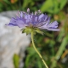
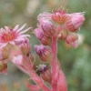
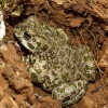
| 14 | Image name | The name of images that illustrate the locality. If more than one image is made available, separate the names with semi-colons (";"). Please provide the image in a separate folder/storage medium. | MMB-008-1.jpg; MMB-008-2.jpg; MMB-008-3.jpg CDC_23890.jpg |
| 15 | Image credit | The photographer, painter, literature source, etc. where the image(s) came from. If more than one image is given, separate credits by semi-colons (";") | Merijn M. Bos 2007; Christoph Haeuser 2007; Klaus Riede 2007 |
| 16 | Macrohabitat notes | Any relevant remark on the habitat that dominates the locality. More precise (microhabitat) remarks can be provided along with later identifications of specimens | "Lime stone ridge, humid, no vegetation besides some bryophytes and lichens" |
| 17 | Remarks | Any other remarks that are relevant for this specific locality (e.g., waypoint, whether the georeference was a starting point of a transect of X meters in direction Y, etc.) | Waypoint 17; Transect of 1250 meters in direction SSE |
| 18 | Date recorded | The date on which these locality data were recorded (DD.MM.YYYY) (important because locality description can change over time) | 14.06.2007 |